Jump to a question in this guide
- What is different about buying a sloping lot?
- What can move downhill, and why does the distinction matter?
- Why look above and below the legal lot?
- How do surface water and ground conditions differ?
- What does a hazard map establish about this address?
- What should you read in a geotechnical report first?
- How can a driveway crossing affect more than access?
- How should access be considered for everyday use?
- Which later changes can make older evidence incomplete?
- How do retaining walls fit into the wider site question?
- What can you safely observe at a viewing?
- Who answers planning, ground, drainage and legal questions?
- What if your purchase depends on changing the slope?
- Fictional case: a driveway invoice and a proposed level yard
- How can you organize a useful purchase brief?
- Terrain and water questions can extend above and below the visible yard.
- A hazard map, a site investigation and an invoice each have their own scope.
- Access paving and the drainage crossing are separate jobs.
- Assess supported current use separately from an essential proposed alteration.
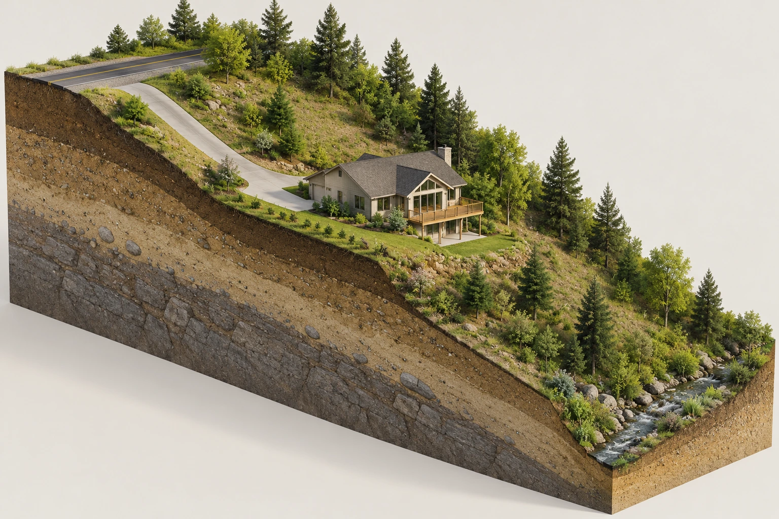
The house occupies a bench reached from an upper road, while the terrain continues to a lower channel. This whole-site relationship makes ground, water and access questions understandable before reading a report focused on only one location.
About this illustration
Generic conceptual cut soil; no verified strata, boundary, safe siting, receiving right or slope stability finding. This is a conceptual teaching model, not an assessment of your home.
8 picture lessons appear beside the questions in this guide. Use them to understand the explanation, then consider what it means for your home.
What is different about buying a sloping lot?
A sloping lot places the home within a larger piece of terrain. Ground above the house can deliver water or material toward it; ground below can form part of its support and drainage context. The road and driveway must also cross that terrain. The useful purchase question is therefore wider than whether the foundation looks straight or a retaining wall has a recent receipt. It is whether the actual site, access and permitted use support the household’s intended purchase.
The whole-site cutaway shows a house on a bench, an approach from higher ground and terrain continuing below. A receiving feature is shown lower on the site so the reader can follow the drainage question beyond the building. The generic cut soil is explanatory artwork, not a borehole log or verified layers. No boundary, safe setback, slope angle or acceptable building position is established by its attractive arrangement.
This guide owns the whole-lot decision. The retaining-wall guide explains individual wall, load and drainage questions; the ground-condition guide covers broader earthquake, permafrost and ground evidence. Here, connect those specific questions with uphill and downhill context, historical changes, access and the actual intended alteration. A small wall repair and a whole-site geotechnical assessment have different purposes, even where both are relevant to the purchase.
Begin with the property’s present use and what must change for the household to live there. A steep garden may be acceptable as it stands while a planned level play area or widened driveway creates another question entirely. Do not walk an unstable edge, investigate falling material or test a wall during a viewing. Where there is an immediate concern about movement or falling material, stay clear and seek appropriate urgent professional or official assistance.
The house sits between higher and lower terrain
The house occupies a bench reached from an upper road, while the terrain continues to a lower channel. This whole-site relationship makes ground, water and access questions understandable before reading a report focused on only one location.
Numbers identify the parts explained below.
- Upper access
Connects the road with the house bench. No access right or road approval is supplied.
- House bench
Locates the occupied building in the terrain. Its illustrated position is not an approved setback or support design.
- Lower terrain
Continues toward a depicted channel. No measured drainage route or lawful discharge is established.
What does this illustration leave out?
Generic conceptual cut soil; no verified strata, boundary, safe siting, receiving right or slope stability finding. This illustration explains an idea. It is not an installation guide.
What relevant terrain and water context did the actual professional scope include?
Explore this with HomeAI ↗Opens an editable question. Nothing is sent until you choose to send it.The house sits between higher and lower terrain
The house occupies a bench reached from an upper road, while the terrain continues to a lower channel. This whole-site relationship makes ground, water and access questions understandable before reading a report focused on only one location.
- Upper access
- Connects the road with the house bench. No access right or road approval is supplied.
- House bench
- Locates the occupied building in the terrain. Its illustrated position is not an approved setback or support design.
- Lower terrain
- Continues toward a depicted channel. No measured drainage route or lawful discharge is established.
What remains unknown: Generic conceptual cut soil; no verified strata, boundary, safe siting, receiving right or slope stability finding.
A useful question: What relevant terrain and water context did the actual professional scope include?
Source context: Regional District of Central Okanagan — Hillside development permit areas; City of Kelowna — OCP Chapter19: Hillside Development Permit Area; City of Kelowna — OCP Chapter20: Hazardous Conditions Development Permit Area
What can move downhill, and why does the distinction matter?
A landslide is movement of rock, soil or debris down a slope. Public Safety Canada explains that landslides can have little warning and can be associated with heavy rain, earthquakes and human activity. They are not restricted to dramatic mountain cliffs. The word covers different materials and movements, so a buyer should not use one remembered news image as a test for whether a particular property needs investigation.
Water flowing over a surface, soil washing away and a mass of ground moving are different observations. They may interact, but one does not automatically establish the other. A muddy track after rain might record surface erosion; it does not alone identify the depth or stability of the ground beneath. Conversely, a tidy surface does not establish the absence of a consequential ground problem outside what is visible.
A geotechnical professional investigates the actual ground question within an agreed scope. Their work may need the terrain setting, material information, water conditions, history and proposed use. This guide supplies no failure-plane diagram for the particular home, no stability calculation and no diagnostic crack threshold. Ask which possible hazards the assessment addresses and which locations, triggers or changes remain outside it.
The distinction changes the purchase request. “Explain the source and receiving route of runoff at this driveway” is a drainage question. “Assess whether the existing slope and proposed excavation are suitable for the intended development” is a different technical brief. They can require coordinated advice rather than competing guesses. Naming the observed condition first lets the relevant professionals decide appropriate methods without the buyer trying to diagnose a hillside from a photograph.
Why look above and below the legal lot?
The physical terrain does not stop at a property line. Water and material can arrive from higher ground, while a lower cut, drainage route or adjoining development can change the context below. A purchase investigation should therefore ask what relevant site assessment considered beyond the visible yard. The buyer should use authorized records and professional advice, not enter neighbouring land or assume a right to alter someone else’s drainage.
The topological plan separates the house, approximate lot outline, higher terrain and lower receiving area. Arrows describe questions about connection, not measured flows. A plan that identifies ownership boundaries has a different job from a geotechnical section or a drainage design. One can help locate another, but none should be silently substituted for the others. Ask who prepared the record and what it was intended to establish.
Kelowna’s current served OCP hazardous-conditions guidance describes assessment that considers effects on surrounding property. The Regional District of Central Okanagan also explains hillside-development concerns involving erosion, instability and neighbouring development. Those are British Columbia local planning examples, not a national rule requiring one report for every sloping lot. They show why off-lot context can matter and why the actual local authority’s current requirements need confirmation.
Ask whether there is a recent development, drainage work, road change or excavation above or below the home. A seller’s lack of awareness is not evidence that none exists. Relevant public records, authorized neighbouring information and a defined site review may help. If consequential context remains inaccessible, keep that limit in the purchase advice. An assessment should state the information it used rather than imply unrestricted access to all surrounding land.
The lot sits within terrain
The house lies between higher and lower terrain. The surrounding context can affect water and ground questions, while a legal boundary has a different purpose from an investigation’s physical coverage.
Numbers identify the parts explained below.
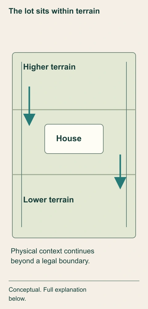
- Higher terrain
Forms part of the site context. Relevant water or material questions can originate beyond the yard.
- House area
Needs location-matched evidence. A footprint alone does not define all terrain influences.
- Lower terrain
Continues the physical setting. Relevant cuts and receiving routes need their own records.
What does this illustration leave out?
Conceptual plan; no surveyed boundary, actual flow, slope angle or assessment. This illustration explains an idea. It is not an installation guide.
What relevant uphill and downhill context did the actual site review consider?
Explore this with HomeAI ↗Opens an editable question. Nothing is sent until you choose to send it.The lot sits within terrain
The house lies between higher and lower terrain. The surrounding context can affect water and ground questions, while a legal boundary has a different purpose from an investigation’s physical coverage.
- Higher terrain
- Forms part of the site context. Relevant water or material questions can originate beyond the yard.
- House area
- Needs location-matched evidence. A footprint alone does not define all terrain influences.
- Lower terrain
- Continues the physical setting. Relevant cuts and receiving routes need their own records.
What remains unknown: Conceptual plan; no surveyed boundary, actual flow, slope angle or assessment.
A useful question: What relevant uphill and downhill context did the actual site review consider?
Source context: Public Safety Canada — Landslides; City of Kelowna — OCP Chapter20: Hazardous Conditions Development Permit Area; Regional District of Central Okanagan — Hillside development permit areas
How do surface water and ground conditions differ?
Surface water travels across roofs, paving and ground before entering an appropriate receiving route. Ground assessment considers the relevant materials, terrain and water conditions within or affecting the ground. These jobs overlap without becoming the same job. A surface drainage improvement may address a defined runoff problem while leaving another ground question outside its scope. A geotechnical report may identify drainage recommendations that still require a suitable detailed implementation.
The paired-path figure follows visible runoff separately from the ground-assessment brief. It contains no invented water table or subsurface failure plane. This matters because a blue arrow below a drawing can easily look like a finding. The actual route, volume, timing and subsurface conditions require their own evidence. Ask whether a statement is an observation, a reported historical event, a model assumption or an assessed conclusion.
Canada’s property-grading guidance explains the value of directing water away from the foundation and recognizing low areas, pooling and erosion. We do not copy its generic dimensions or grading instructions onto a steep site. Adding fill or redirecting water can have consequences elsewhere, and Public Safety Canada specifically warns against increasing flow down a slope or undercutting it. The appropriate response is defined local advice, not an improvised landscape fix during the purchase.
Useful evidence can include dated observations, identified drainage drawings and the scope of completed work. A dry viewing day does not establish storm performance; a single wet photograph does not establish a permanent route or cause. Ask what seasonal or event conditions the assessment considered. Where the buyer’s decision depends on an explanation, obtain a scope that connects the observed location with the relevant water and ground questions.
Water route and ground scope
The upper route follows surface water across terrain. The lower field names the information a defined ground assessment may need. Keeping them separate avoids turning a drainage improvement into an unlimited ground-stability finding.
Numbers identify the parts explained below.
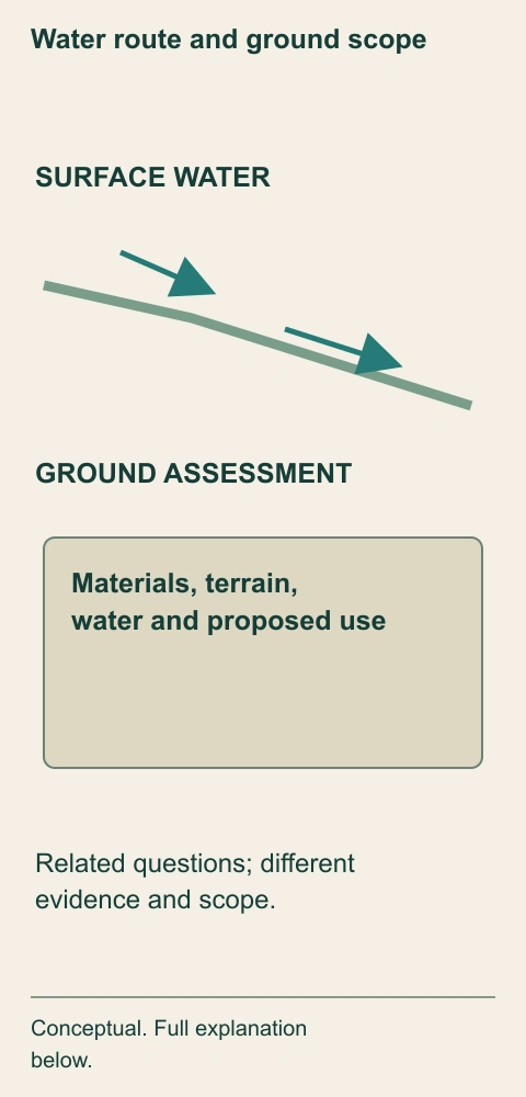
- Surface route
Carries runoff. Its actual receiving route needs relevant evidence.
- Ground context
Needs its own assessment. The figure supplies no concealed findings.
- Coordinated question
Connects relevant scopes. One completed task does not automatically finish the other.
What does this illustration leave out?
No actual runoff measurement, water table, subsurface layer or failure plane. This illustration explains an idea. It is not an installation guide.
Which scope connects the observed water location with any consequential ground question?
Explore this with HomeAI ↗Opens an editable question. Nothing is sent until you choose to send it.Water route and ground scope
The upper route follows surface water across terrain. The lower field names the information a defined ground assessment may need. Keeping them separate avoids turning a drainage improvement into an unlimited ground-stability finding.
- Surface route
- Carries runoff. Its actual receiving route needs relevant evidence.
- Ground context
- Needs its own assessment. The figure supplies no concealed findings.
- Coordinated question
- Connects relevant scopes. One completed task does not automatically finish the other.
What remains unknown: No actual runoff measurement, water table, subsurface layer or failure plane.
A useful question: Which scope connects the observed water location with any consequential ground question?
Source context: Government of Canada — Property grading; Public Safety Canada — Landslides: How to prepare
What does a hazard map establish about this address?
A hazard or planning map organizes information across an area. It can identify a reason to ask for local requirements or a more detailed assessment. It does not automatically supply a property-specific condition finding, and an apparently clear map location does not guarantee that every relevant hazard has been investigated. The buyer needs the map’s purpose, date, scale and accompanying explanation before treating its shading as an answer.
Kelowna’s OCP hazardous-conditions chapter explains that an indicated area can have approximate boundaries and may require site-specific determination. Its hillside and hazardous-conditions chapters have different planning purposes. Both served pages display a January 10, 2022 update. We retain that local and dated context without adopting their thresholds, exemptions or report requirements as current rules for the rest of Canada.
The map-versus-investigation figure uses two different frames. A broad area map identifies a planning question; a smaller investigation footprint identifies where and when specific work was done. The drawing is intentionally conceptual, without a real municipal base map or a reassuring “safe” colour. A report for an adjacent parcel or only one building footprint cannot automatically be extended to every proposed use of the buyer’s lot.
Ask the local authority which current mapping, notices and application requirements apply to the exact address and intended work. Ask the professional how the mapping informed their scope and what additional investigation was necessary. Keep the actual answers with the purchase file. A screenshot from an old listing or a general online map should not become the sole basis for a consequential ground, access or development decision.
Map area is not a site finding
The broad map field and the smaller investigation footprint answer different questions. An area designation can prompt enquiry; a report’s actual location, date and purpose determine what its site evidence addresses.
Numbers identify the parts explained below.
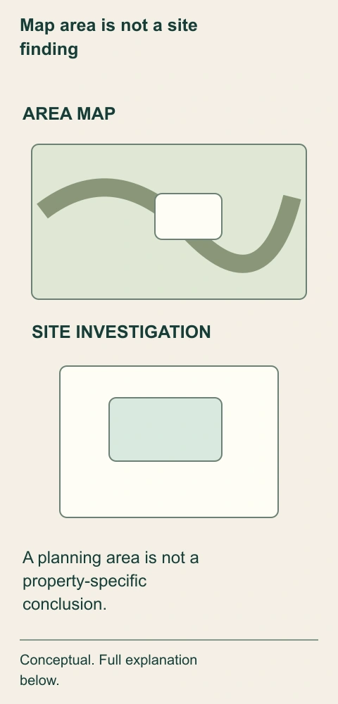
- Area information
Organizes a planning or hazard question. Its scale and date stay attached.
- Investigation footprint
Identifies where work occurred. Adjacent work does not automatically cover this lot.
- Actual conclusion
Depends on its scope. Keep methods, conditions and limits with it.
What does this illustration leave out?
Invented diagram, not a municipal map or a safe-area classification. This illustration explains an idea. It is not an installation guide.
Which current local mapping applies, and what does the property-specific work actually cover?
Explore this with HomeAI ↗Opens an editable question. Nothing is sent until you choose to send it.Map area is not a site finding
The broad map field and the smaller investigation footprint answer different questions. An area designation can prompt enquiry; a report’s actual location, date and purpose determine what its site evidence addresses.
- Area information
- Organizes a planning or hazard question. Its scale and date stay attached.
- Investigation footprint
- Identifies where work occurred. Adjacent work does not automatically cover this lot.
- Actual conclusion
- Depends on its scope. Keep methods, conditions and limits with it.
What remains unknown: Invented diagram, not a municipal map or a safe-area classification.
A useful question: Which current local mapping applies, and what does the property-specific work actually cover?
Source context: City of Kelowna — OCP Chapter19: Hillside Development Permit Area; City of Kelowna — OCP Chapter20: Hazardous Conditions Development Permit Area
Map, report and invoice have different jobs
- Area mapOrganizes an area-level planning or hazard question Read date, scale and actual local meaning.
- Professional reportAddresses a defined site purpose and scope Read conditions and actual investigation footprint.
- Work invoiceRecords selected supplied work Match it to the recommendation and completed location.
No actual property finding or project approval.
Further reading: City of Kelowna — OCP Chapter20: Hazardous Conditions Development Permit Area; Regional District of Central Okanagan — Hillside development permit areas.
What should you read in a geotechnical report first?
A geotechnical report records an investigation and professional conclusions for a defined purpose. Start with the property, author, date, client, proposed work and areas addressed. Then read the information and methods used, the conclusions, recommendations and limitations. These parts belong together. A reassuring sentence copied into a listing may omit the conditions that make it relevant or reveal that the report was prepared for a different project.
The RDCO hillside guidance describes staff determining appropriate professional input and, for many development projects, a geotechnical assessment whose accepted recommendations become permit conditions. This is a regional development process, not a promise that a report permits any existing or proposed use. A buyer should ask the relevant authority and professional what reliance, updating or additional scope is appropriate for the actual transaction and intended alteration.
Read for physical coverage as well as wording. Which part of the lot was investigated, what information was available, and what was not accessible? Was the work about an existing house, a driveway, a retaining structure or proposed excavation? A report may appropriately answer one question while leaving others for another professional. Calling every technical document a “soil report” hides those distinctions and makes comparison harder.
Finally, trace recommendations to their present status. A recommendation to manage water is not evidence that the relevant work was designed, authorized, completed and maintained. A later invoice may cover only part of it. Request the matching drawings, completion records and current professional response where needed. Do not create a fictional certification from a report title, or assume an old recommendation is invalid solely because it remains visible in an earlier document.
How can a driveway crossing affect more than access?
A driveway provides a route between the road and the house. Where it crosses a roadside ditch, a culvert may carry water through the crossing so the driveway does not simply block that route. The driveway surface and the drainage crossing therefore perform different jobs in the same place. A fresh paving invoice may address the driving surface without establishing the culvert’s condition, receiving route or suitability.
The crossing cutaway illustrates a single barrel continuing beneath the driveway along the ditch route. Its job is to make the physical relationship understandable, not to prescribe a pipe size, grade, material or inlet detail. The actual public-road interface can also involve access approvals and maintenance responsibilities. These need their own documents and the appropriate local authority’s answer, separate from a contractor’s description of the paving work.
Halton Hills’ current drainage page explains culverts at driveway crossings and asks property owners to have Public Works assess relevant work before paving. Its ownership and municipal-maintenance explanations are Ontario municipal examples, not a Canada-wide allocation of responsibility. We adopt no local dimensions, fees or installation procedure. The lesson for another location is to ask who owns, authorizes and maintains each actual component there.
For the purchase, identify whether the approach and crossing are essential to the intended access and what records explain them. Ask about previous drainage complaints, repairs, work affecting the ditch and the status of any recommendation. Do not climb into a culvert or try to clear or redirect water as a buyer. An apparent open mouth does not establish the complete barrel, outlet, capacity or lawful receiving route.
A culvert lets the ditch cross beneath a driveway
The driveway crosses a roadside ditch above one continuous culvert barrel. The drawing removes the middle driveway cover and the pipe’s upper half so the passage can be seen. Access above and water passage below are different jobs in the same crossing.
Numbers identify the parts explained below.
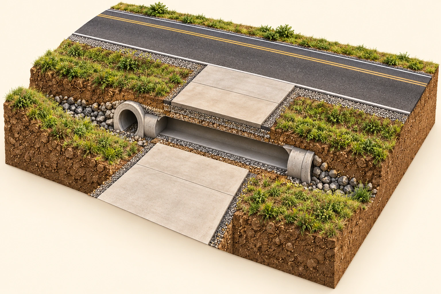
- Driveway crossing
Carries access over the ditch. The centre has been cut away only to teach the relationship.
- Culvert barrel
Carries the ditch route through the crossing. One left mouth and a far right exterior rim are shown on the same axis.
- Roadside ditch
Continues alongside the road. Its destination and responsibility need local records.
What does this illustration leave out?
Cutaway removal is explanatory, not damage or an exposed actual pipe; no size, capacity, material specification, ownership or approved design. This illustration explains an idea. It is not an installation guide.
Which actual records address both the access surface and the drainage crossing?
Explore this with HomeAI ↗Opens an editable question. Nothing is sent until you choose to send it.A culvert lets the ditch cross beneath a driveway
The driveway crosses a roadside ditch above one continuous culvert barrel. The drawing removes the middle driveway cover and the pipe’s upper half so the passage can be seen. Access above and water passage below are different jobs in the same crossing.
- Driveway crossing
- Carries access over the ditch. The centre has been cut away only to teach the relationship.
- Culvert barrel
- Carries the ditch route through the crossing. One left mouth and a far right exterior rim are shown on the same axis.
- Roadside ditch
- Continues alongside the road. Its destination and responsibility need local records.
What remains unknown: Cutaway removal is explanatory, not damage or an exposed actual pipe; no size, capacity, material specification, ownership or approved design.
A useful question: Which actual records address both the access surface and the drainage crossing?
Source context: Town of Halton Hills — Drainage concerns
How should access be considered for everyday use?
Access is more than the visual appeal of a winding driveway. The household needs to reach the home under the conditions in which it will actually be used. A steep approach, narrow turning area or shared route may raise questions about ordinary access, maintenance and proposed changes. The purchase should separate a physical route shown on a plan from the legal rights and approvals that allow its intended use.
Ask which survey, title information, agreements and local records define the route. A tire track across adjoining land is not a legal access opinion. Likewise, a document recording a right needs appropriate interpretation before it is assumed to allow widening, reconstruction, parking or drainage changes. A local property lawyer or other qualified transaction adviser should address the applicable rights and obligations rather than having the buyer infer them from the terrain picture.
Keep seasonal practicality within an appropriate scope. Ask what maintenance arrangement exists and what relevant history can be documented. The guide does not supply a safe driving grade, emergency-vehicle approval or winter-performance guarantee. A road or access professional and the applicable authority can address consequential physical requirements; the transaction adviser can explain the actual documents. Different questions may need different people.
If access changes are essential, request feasibility and approval advice before relying on them. An attractive turning-area sketch cannot establish room to build, suitable ground or permission to alter drainage at the road. The whole-lot decision should include the existing access if the proposed change is not yet supported. This avoids buying on the unsupported assumption that every difficult approach can be widened or levelled after possession.
Which later changes can make older evidence incomplete?
An older report describes a purpose and conditions at a time. Later cuts, fills, walls, drainage changes or adjacent work can create new questions about whether its conclusions and recommendations remain applicable. Age alone does not decide usefulness. The relevant comparison is between the documented basis of the report and what actually changed, including any work the original author anticipated or required.
The timeline figure puts an old site report, later driveway work and a present alteration proposal in sequence. It does not mark the later work as defective. Instead it asks whether the report’s assumptions still match and whether the relevant professional has addressed the change. The sequence makes a purchase question concrete without pretending that a chronological gap is itself a technical diagnosis.
Collect location-matched records rather than a stack of unrelated invoices. A wall repair at one edge may not address an excavation below the house. A drainage cleaning record may not establish the effects of a new outlet. Where the seller reports that work was “approved,” ask what was approved, by whom, under what document and whether the final completed work is the work described. Avoid turning hearsay into a permit or condition finding.
The appropriate professional can explain whether an update, a different investigation or no additional work is warranted for the intended decision. Keep that answer separate from the buyer’s own observation. Do not excavate, expose a foundation or disturb a slope to recreate an old drawing. Where the report cannot be reconciled with a consequential known change, state the uncertainty and assess its effect on the purchase before relying on the earlier conclusion.
Match old scope to later change
The fictional sequence separates an earlier house-platform report, later driveway work and a new yard proposal. It asks whether assumptions and recommendations remain relevant without declaring any later work defective.
Numbers identify the parts explained below.
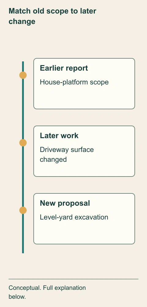
- Earlier scope
Records a purpose at a time. Read its conditions and coverage.
- Later change
May create a new question. An invoice has its own scope.
- Current proposal
Needs relevant feasibility advice. Old evidence does not automatically approve it.
What does this illustration leave out?
Illustrative chronology; no actual report, work, defect or approval. This illustration explains an idea. It is not an installation guide.
Has the relevant professional addressed consequential changes since the earlier investigation?
Explore this with HomeAI ↗Opens an editable question. Nothing is sent until you choose to send it.Match old scope to later change
The fictional sequence separates an earlier house-platform report, later driveway work and a new yard proposal. It asks whether assumptions and recommendations remain relevant without declaring any later work defective.
- Earlier scope
- Records a purpose at a time. Read its conditions and coverage.
- Later change
- May create a new question. An invoice has its own scope.
- Current proposal
- Needs relevant feasibility advice. Old evidence does not automatically approve it.
What remains unknown: Illustrative chronology; no actual report, work, defect or approval.
A useful question: Has the relevant professional addressed consequential changes since the earlier investigation?
Source context: Regional District of Central Okanagan — Hillside development permit areas; City of Kelowna — OCP Chapter20: Hazardous Conditions Development Permit Area; Public Safety Canada — Landslides: How to prepare
How do retaining walls fit into the wider site question?
A retaining wall holds back material at a defined location. Its structure, support and drainage need their own assessment, but the wall is also part of a surrounding site. Water arriving from higher ground, loads near the wall and work below it can matter to the relevant technical scope. A wall invoice should therefore be matched to the actual wall and to the broader recommendations it was intended to address.
The separate retaining-wall guide explains wall forms, loads and drainage in greater detail. This guide does not duplicate a wall-design lesson or supply an owner repair recipe. The whole-lot question is whether the assessment considered the relationships needed for the buyer’s intended use. A small decorative garden wall and a consequential supporting structure should not be grouped together simply because both have a visible stone face.
A property might have several walls installed at different times with different records. Label their locations on a simple authorized plan and match each document to its wall. If a report addresses only one, keep the others outside its conclusion. A fresh finish or planted slope may conceal relevant surfaces, but appearance alone does not decide whether a problem exists. Ask the professional what access and evidence are appropriate.
Do not lean on, climb or load a wall to investigate it. If movement, loose material or a potential collapse raises an immediate concern, stay clear and notify the responsible person for appropriate help. For a planned new wall, widening or excavation, obtain a defined feasibility and local-approval response. The fact that an older wall remains standing is not permission to change the surrounding ground or loading.
What can you safely observe at a viewing?
From an ordinary safe viewing route, note the arrangement of the house, road, visible drainage features and surrounding terrain. Record locations and dates for relevant observations such as pooling, erosion, cracks, seepage or reported past incidents. An observation should describe what was actually seen, not convert it into “active landslide,” “settlement only” or a technical explanation supplied by an unqualified observer.
Public Safety Canada’s landslide guidance identifies warning signs and emphasizes that movement can occur with little notice. A viewing is not a reason to approach a suspected moving area to obtain a better photograph. Stay clear of immediate hazards and follow appropriate local emergency or professional advice. This guide does not replace official emergency instructions or provide a remote method of declaring a slope safe to enter.
Alternatives prevent premature conclusions. A crack in a paved surface can have more than one explanation; damp ground can reflect different water routes and conditions. That does not make the observation unimportant. It means the relevant professional needs its location, context and history to decide appropriate investigation. A dry surface, mature planting or an absence of visible cracks likewise does not establish every concealed or off-lot condition.
Ask what the seller knows and what records support it. Keep reported history attributed: “seller reports runoff here during spring” is different from a dated assessment of the route and cause. With permission, ordinary photographs can help connect questions to locations without disturbing the property. The useful outcome is a clear investigation brief and a bounded purchase record, not a homeowner test or a catalogue of guessed defects.
Who answers planning, ground, drainage and legal questions?
The local authority explains current planning and application requirements for the address and proposed work. A geotechnical professional addresses the defined ground and stability questions. Other appropriate design or drainage professionals may address detailed water-management and access work. A property transaction adviser addresses the actual rights, obligations and contract consequences. These roles can coordinate, but their answers should retain their individual scope.
Kelowna’s hillside and hazardous-conditions chapters illustrate why the planning purpose matters. One addresses development form and terrain relationships, while another addresses hazardous conditions and professional assessment. RDCO has its own hillside-development process. Do not carry a threshold or exemption from one jurisdiction into another, or mistake an online policy explanation for a current project-specific permit decision.
Give each person the same essential facts: the address, intended use, known work history, relevant reports and specific outstanding question. Ask who must coordinate related work and how recommendations become a defined proposal. A document labelled “consultation” may be a useful initial conversation without being a complete assessment. Keep estimates, applications, approvals and completion evidence distinct so that proposed work is not counted as finished.
If the answers conflict or do not connect, ask for clarification before choosing the most reassuring sentence. A local approval can concern a defined application without providing a current assessment of every site condition. A technical opinion can address feasibility without granting legal access or municipal permission. The purchase needs the combination appropriate to its intended use, and should not rely on any professional having silently answered questions outside the agreed brief.
What if your purchase depends on changing the slope?
A plan to create a level yard, widen a driveway, add a room or build an outdoor structure can change the purchase from acceptance of an existing site to reliance on a new project. Excavation, fill, altered drainage and added loading can have consequences beyond the visible work area. Public Safety Canada warns against undercutting slopes and increasing downhill water flow. These are reasons for appropriate investigation, not design rules for a buyer to implement.
Describe the essential result in ordinary terms before asking about feasibility. “We need an accessible route to this entrance” is more useful than an unsupported sketch showing a new cut and wall. The relevant professionals can then identify the actual ground, access, design and approval questions. A concept drawing should remain a concept until those answers exist; its attractive appearance supplies no permission or technical suitability.
The decision diagram separates accepting supported current use from relying on an unconfirmed alteration. It includes an option to seek another property where an essential need cannot yet be supported. That is a decision framework, not a recommendation to abandon every hillside house. The appropriate answer depends on the buyer’s needs, actual evidence and advice, rather than on a generic preference for flat or steep land.
Obtain realistic scope and cost advice where work is potentially feasible, while preserving uncertainty about approvals and concealed conditions. A contractor’s informal price for earthmoving may omit engineering, access, drainage, permits and other dependencies. Do not treat a seller’s proposed project as completed value. If the essential plan remains unresolved, the transaction advice should address that uncertainty explicitly instead of assuming it will be easy to settle after possession.
Separate use from alteration
The decision begins with the household need, then asks whether supported current use meets it. An essential new alteration needs its own feasibility and local approval answers before becoming part of the purchase basis.
Numbers identify the parts explained below.
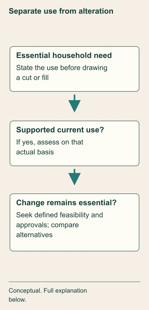
- Household need
Defines the decision. Describe the result rather than assume an earthwork solution.
- Current use
Provides a supported baseline. A new proposal is a separate question.
- Essential alteration
Needs defined answers. Another property remains a real alternative.
What does this illustration leave out?
No project design, permission, technical finding or recommended transaction outcome. This illustration explains an idea. It is not an installation guide.
Does the property still suit the household if the proposed change cannot yet be relied upon?
Explore this with HomeAI ↗Opens an editable question. Nothing is sent until you choose to send it.Separate use from alteration
The decision begins with the household need, then asks whether supported current use meets it. An essential new alteration needs its own feasibility and local approval answers before becoming part of the purchase basis.
- Household need
- Defines the decision. Describe the result rather than assume an earthwork solution.
- Current use
- Provides a supported baseline. A new proposal is a separate question.
- Essential alteration
- Needs defined answers. Another property remains a real alternative.
What remains unknown: No project design, permission, technical finding or recommended transaction outcome.
A useful question: Does the property still suit the household if the proposed change cannot yet be relied upon?
Source context: Public Safety Canada — Landslides: How to prepare; City of Kelowna — OCP Chapter19: Hillside Development Permit Area; City of Kelowna — OCP Chapter20: Hazardous Conditions Development Permit Area
Current use and future alteration are separate decisions
- Supported existing useCan form a present purchase basis Confirm it fits the household’s essential needs.
- Essential proposed alterationNeeds its own feasibility and local answers Do not count a sketch as approved work.
- Alternative propertyMay avoid an unsupported essential assumption A transaction choice, not a technical slope verdict.
Conceptual purchase framework, no legal or engineering decision.
Further reading: Public Safety Canada — Landslides: How to prepare; City of Kelowna — OCP Chapter19: Hillside Development Permit Area; City of Kelowna — OCP Chapter20: Hazardous Conditions Development Permit Area.
Fictional case: a driveway invoice and a proposed level yard
Noah is considering a house on a sloping lot. The invented file contains an older geotechnical report for the house platform, a later driveway-paving invoice and a current listing sketch showing a future level lawn below the home. The report does not cover the lawn excavation, and the paving invoice does not describe the roadside crossing. These are fictional documents used to show a decision process, not actual property findings.
Noah’s household can use the existing house but considers the level outdoor area important. One plausible explanation is that the proposed change could be feasible with a defined design and approvals. Another is that ground, drainage, access or local conditions could materially change or prevent the proposal. Neither the older house-platform report nor the attractive lawn sketch selects between those explanations. The purchase has an essential unanswered project question.
Noah asks the relevant local authority about the proposed work and obtains appropriately scoped professional advice about ground, water and access. He also asks who is responsible for the existing road crossing and what evidence addresses its current condition. These requests remain separate from the paving invoice. He does not commission excavation, clear a ditch or redirect water to see whether the concept works during a viewing.
Until the responses support the intended alteration, Noah evaluates the home with its existing sloped outdoor area and obtains transaction advice about the unresolved need. If that basis does not suit the household, another property is a real alternative. The fictional outcome is a clearer purchase basis, not an invented engineering pass, permit, safe slope, approved lawn or repair budget. The decision changes when evidence addresses the actual proposed work.
A lawn sketch is still a proposal
Noah’s fictional report and paving invoice leave the lawn excavation and road crossing outside their established scopes. His next step seeks separate relevant answers and evaluates existing use in the meantime.
Numbers identify the parts explained below.
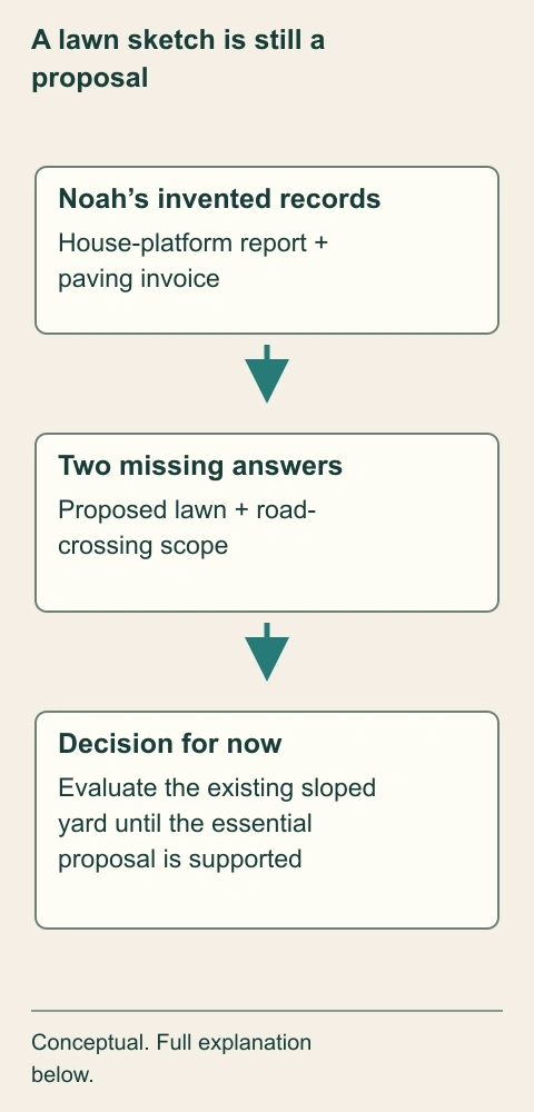
- Existing records
Support their own stated work. They do not become a new excavation design.
- Missing answers
Define the current scope. Ground, water, access and local requirements may need coordination.
- Purchase basis
Uses supported existing conditions. An essential unresolved plan changes the decision.
What does this illustration leave out?
Entirely fictional; no safe slope, approval, engineering pass, repair price or transaction. This illustration explains an idea. It is not an installation guide.
What evidence would support relying on the essential alteration rather than the existing yard?
Explore this with HomeAI ↗Opens an editable question. Nothing is sent until you choose to send it.A lawn sketch is still a proposal
Noah’s fictional report and paving invoice leave the lawn excavation and road crossing outside their established scopes. His next step seeks separate relevant answers and evaluates existing use in the meantime.
- Existing records
- Support their own stated work. They do not become a new excavation design.
- Missing answers
- Define the current scope. Ground, water, access and local requirements may need coordination.
- Purchase basis
- Uses supported existing conditions. An essential unresolved plan changes the decision.
What remains unknown: Entirely fictional; no safe slope, approval, engineering pass, repair price or transaction.
A useful question: What evidence would support relying on the essential alteration rather than the existing yard?
Source context: Public Safety Canada — Landslides: How to prepare; Regional District of Central Okanagan — Hillside development permit areas; Town of Halton Hills — Drainage concerns
How can you organize a useful purchase brief?
Use a location-based brief rather than a single “hillside checked” box. Identify the existing house, upper and lower terrain context, essential access, visible drainage features and any consequential wall or proposed alteration. For each, record the question, available evidence, professional or authority responsible and remaining uncertainty. This keeps a strong report from being used outside its scope and a modest observation from being discarded because it is not a diagnosis.
Attach the relevant dates and locations. A report, plan, invoice and photograph can be connected only when they refer to the same work and place. Mark reported history as reported and proposed work as proposed. Where a source is a broad map or policy, preserve its scale and jurisdiction. Where it is a professional conclusion, preserve the purpose, methods, conditions and limitations that give the conclusion meaning.
The brief should also state what the household must be able to do. Ordinary present use, a level yard and a widened road approach are different requirements. That statement lets technical and transaction advice focus on the right consequence. A buyer can then decide whether supported current use is enough, whether a defined investigation is needed or whether an essential assumption remains too uncertain to rely on.
Keep the regional limits visible: national preparedness guidance explains hazards and cautions; Canada’s grading page addresses property flood readiness; RDCO and Kelowna explain particular BC planning contexts; Halton Hills supplies an Ontario drainage example. None is a property diagnosis or a national hillside approval. The useful result is an informed purchase decision and a coherent professional brief, with uncertainty kept specific rather than hidden behind either reassurance or alarm.
Keep learning about the connected parts
- Retaining walls: understand ground, water and nearby loads
- Ground, earthquakes and permafrost: understand what supports a home
- How a house is supported: floors, walls, beams and changes
- A line in the basement: build a useful foundation observation record
Canadian context and authorities · Visual atlas · Learning labs
Practice the distinction.
Fictional case: the future lawn is still a proposal
Noah’s invented hillside file has an old house-platform report, a later paving invoice and a listing sketch for a future level lawn.
Reported observations
- The report does not assess the lawn excavation.
- The paving invoice does not describe the road drainage crossing.
- The level outdoor area is important to Noah’s household.
Compare the explanations
Expand each possibility to see the evidence needed to distinguish it. Similar symptoms can have different mechanisms.
A defined project might be feasible
The existing records do not establish the technical and local answers.
Obtain appropriate ground, drainage, access and authority responses for the intended work.
Conditions could materially change or prevent the proposal
A lawn sketch does not decide the relevant ground or approval question.
Read the actual professional scope and local requirements before relying on the change.
A useful next question
Noah evaluates the existing sloped yard until the essential alteration is supported; if that use does not suit the household, another property is a genuine alternative addressed with transaction advice.
Entirely fictional. No engineering pass, safe slope, approval, repair budget or actual transaction.
Know what the words mean.
- Landslide
- Movement of rock, soil or debris down a slope, with different possible materials and behaviours.
- Geotechnical assessment
- A defined professional investigation of relevant ground and site questions using its stated information and methods.
- Surface runoff
- Water travelling across the ground or other surfaces toward a receiving route.
- Receiving route
- The actual destination and continuation of drainage, requiring appropriate technical and local context.
- Culvert
- A conduit carrying water through a crossing such as a driveway over a ditch.
- Investigation footprint
- The actual locations covered by an investigation, distinct from a whole mapped planning area.
- Cut and fill
- Removal or addition of ground material, changes that can require relevant design and local advice.
- Assessment scope
- The purpose, locations, methods, conditions and exclusions attached to a professional conclusion.
Questions to bring
to the conversation.
- What terrain and drainage context did the actual assessment consider?
- Which changes occurred after the report’s stated basis?
- Who owns, authorizes and maintains the relevant access and drainage components locally?
- Does the property suit the household if the essential proposed alteration remains unsupported?
Separate a showing observation, an existing record and a new professional assessment. Unknown means a question remains; it does not automatically mean a defect.
Use the evidence planner ↗Go to the source.
Original HomeAI explanation informed by these public references. Sources support the underlying guidance; they have not reviewed or endorsed HomeAI. Diagrams are conceptual, and calculator outputs depend on your inputs.
National preparedness and flood-readiness guidance supplies bounded mechanisms and safe questions. RDCO and Kelowna are distinct BC planning examples; January 10, 2022 is the served Kelowna update, not a nationwide current code. Halton Hills is an Ontario drainage example. Provincial PDF/NRCan/other local access holds add no claims. No grade, setback, stability threshold, ground diagnosis, land right, approval or owner earthwork procedure.
Publication & source review
First published .
Sources reviewed .
- Public Safety Canada — Landslides
- Public Safety Canada — Landslides: How to prepare
- Government of Canada — Property grading
- Regional District of Central Okanagan — Hillside development permit areas
- City of Kelowna — OCP Chapter19: Hillside Development Permit Area
- City of Kelowna — OCP Chapter20: Hazardous Conditions Development Permit Area
- Town of Halton Hills — Drainage concerns
Have a question about your home?
Start with the symptom, timing and what you have observed.
Ask HomeAI